Mayor Seeks Support For Additional Flood Protection
Mayor Leirion Gaylor Baird today said proposed changes to Lincoln’s flood protection guidelines are necessary now to keep vulnerable families, homes and businesses safe. The mayor’s announcement was made in advance of a Planning Commission public hearing November 16 and City Council public hearing December 12 to consider changes to the City’s Flood and Water Quality Protection Manual.
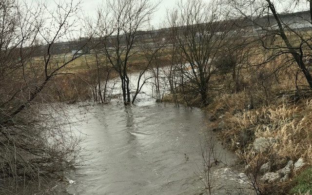
Mayor Gaylor Baird noted that existing flood map elevations from 1961 are too low, based on the 2019 Salt Creek Resiliency Study and updated rainfall totals from the National Oceanic and Atmospheric Administration. City of Lincoln Watershed Management and the Federal Emergency Management Agency (FEMA) have begun updating the flood map, she said, but the process will take five to eight years to complete.
“We need to take action in the interim to update the flood protections that will help keep homes, businesses, and people safe,” said Mayor Gaylor Baird. “By taking action now, we will help ensure affordable housing is built safely. We also will help our community members in the floodplain protect themselves, their families, and their businesses from the increased risk of floods that data – and our own experience – has made clear.”
The proposed changes are the result of a long-term partnership between the City and Lower Platte South Natural Resources District to document weather data and engage the community through public workshops over the last three years, said Donna Garden, Assistant Director of Utilities. Engineers, environmentalists, business owners, developers, and neighborhood representatives all provided input and helped create the updated flood protection proposal.
Because the study demonstrated the flood maps are too low, the updated interim standards would require an extra foot of elevation to protect buildings against rising floodwaters. The proposed changes would begin in 2023 and affect only new construction within the floodplain, an existing structure in the floodplain undergoing renovations of more than 50% of the structure’s value, or construction and rehabilitation projects immediately adjacent to the floodplain with low elevations.
Additional updates will improve water flow and water quality when designing and improving flood corridors, detention ponds, storm drainage systems, where water flows on streets, and erosion and sentiment management.
“Our proactive efforts to update building and development standards will pay off in flood damage prevention and flood insurance savings for the entire community. Raising elevation of the ground will protect property owners from the risk of flooding that exists now and the potential of being mapped into the floodplain as we upgrade our maps,” Garden said. “These changes provide additional security and future viability for our residents and business owners who are investing in these properties.”
Urban Development Director Dan Marvin said the City has funding resources to help build projects safely and keep them affordable. Marvin said FEMA studies show the increase in construction cost to build safely is typically between 0.25% to 1.5%. For example, the City’s new expanded tax increment financing policy increases available affordable housing funding resources by nearly 20% – which helps offset the associated incremental cost to build safely.
Grant Daily, former president of South Salt Creek Community Organization, served as a neighborhood representative on the Salt Creek Resiliency Study Stakeholder Committee that worked with technical experts for two years to understand the increasing flooding issues due to climate change and helped draft the recommendations in the proposal. Those discussions showed how flood maps do not accurately reflect the depth of floodwaters due to increased rainfall, he said.
“We know these updates are just one part of a number of flood protection strategies that the City has underway and will continue into the future. These flood protection updates are an important step,” Daily said.
Foster Collins, who has served on multiple community advisory committees, including the Flood Plain Management Task Force in 2004, said Lincoln has a long history of using scientific data and analysis to create sound public safety policies. Updating our flood protection will help guide Lincoln’s growth in safe and successful ways, he said.
“While there are those who will argue for delay and more studies, we already know that flood levels are rising, the floodplain is expanding, and some of our citizens are at risk and may not even be aware of it,” Collins said.
Blaze Events

Clash at The Complex
3 days ago
Spring Game Tailgate!
4 days ago
In This Moment – Ice Nine Kills
4 days ago
Rival Sons – Clutch
4 days ago