LTU Uses Unmanned Aerial Vehicle for Street Inspection
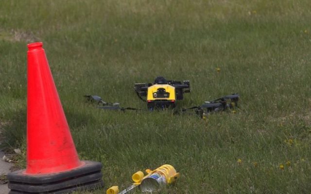
(KFOR NEWS April 22, 2021) Lincoln Transportation and Utilities (LTU) is using an unmanned aerial vehicle to inspect pavement and curb conditions on Adams Street.
LTU Director Liz Elliott said the use of drones significantly reduces the time it takes to evaluate infrastructure in the public right of way, including curbs and pavement condition, for potential maintenance work.
“This new drone technology provides the opportunity to complete street surveys in a fraction of the time. This decreases staff costs, closure inconveniences and increases safety,” Elliott said. “For this particular survey, instead of a two-day closure, the drone can collect the same information in just one hour. That is more than a 90 percent reduction in evaluation time.”
The first drone survey took place April 21 on Adams Street between North 36th and North 46th streets. LTU closed the area in one and two block segments for five to 10 minutes each to allow a drone to fly above the street with no vehicles below. Wednesday’s flights were conducted by a pilot from Benesch Engineering using aircraft owned by the firm.
For more information about this project, contact Kris Humphrey at 402-326-1176 or [email protected]. Current information on street closures is available at lincoln.ne.gov/closures or through the Waze mobile app.
READ MORE: Another Drive-Thru Vaccination Effort Planned This Weekend
Blaze Events

Lincoln Calling
3 days ago
Clash at The Complex
1 week ago
Spring Game Tailgate!
1 week ago
In This Moment – Ice Nine Kills
1 week ago